Latest News: Autodesk acquires ProjectExplorer

Read the announcement from Autodesk
  • The Ultimate Extension for Autodesk Civil 3D
    A better way to review, modify, validate, and report information from your design.

The ultimate extension for Autodesk Civil 3D

Review your Civil 3D design and automate the production of reports, spreadsheets, AutoCAD tables and drawings - with ProjectExplorer 6.

There is a staggering array of information stored within average Civil 3D project. However, accessing and sharing this information can be a real challenge even for the most experienced Civil 3D user.

ProjectExplorer is an easy to use, user-configurable, interactive window which is launched from within Civil 3D. Often considered to be a more powerful alternative to the Civil 3D Prospector, ProjectExplorer features a range of functionality including a powerful report & table generator, essential editing & design review tools, and much more.

Learn about the basic features in ProjectExplorer
10 minutes
  • Review

    Review the contents of your Civil 3D project through a tabbed series of object lists, profile and section views, parameter lists, and many other design review tools.

  • Modify

    Double-click any highlighted parameter to apply a direct edit without the need to delve through Civil 3D's myriad of modal Object Properties dialogs.

  • Validate

    Validate your design using an extensive range of dynamic tooltips which effortlessly reveal portions of the model which may not meet specified design goals.

  • Report and Share

    Automate the production of user configurable reports, spreadsheets, dynamic tables, and AutoCAD drawings from any part of your Civil 3D model - with a single mouse click.

What's New in ProjectExplorer 6?

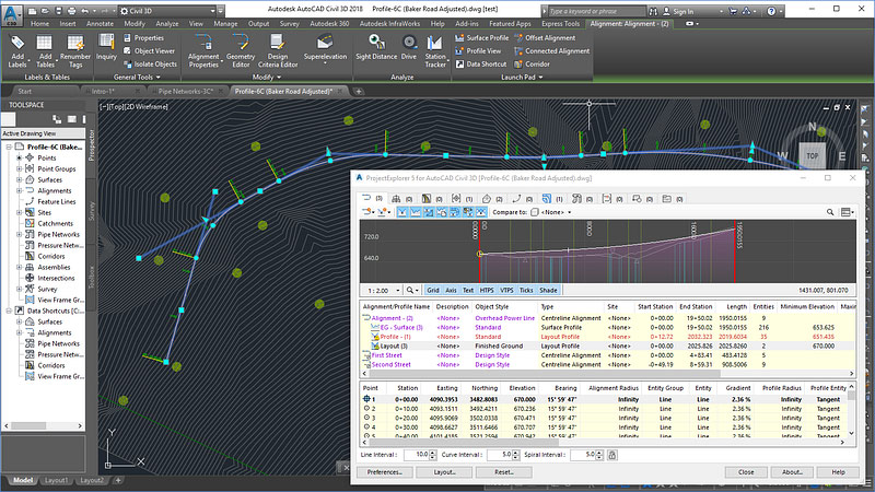
Enjoy a beautiful new user interface design.

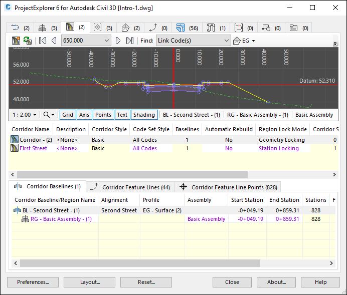
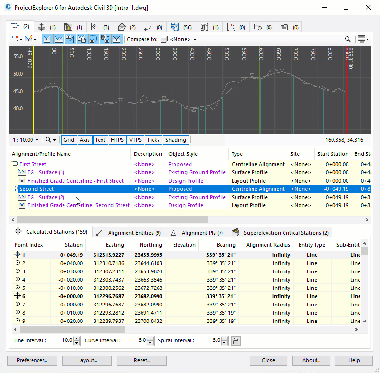
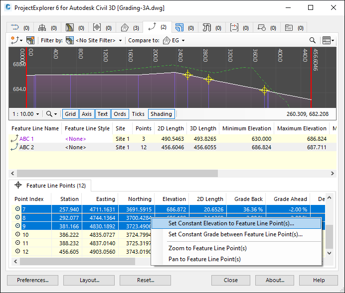
In ProjectExplorer 6, we have introduced a cleaner, less cluttered user interface.

The new tabbed layout at sub-object level makes it even easier to gain a better understanding of your design at a glance, as well as providing opportunities for future expansion of the product.

Discover 5 new ways to review and report alignments and profiles.

In ProjectExplorer 6, there are now many ways to review and report alignment and profile geometry.

Get direct access to a list of station/chainage intervals, entities, PIs, PVIs, or critical superelevation stations/chainages.

Validate any entity at a glance using violation tooltips - now with Design Check Set support.

Experience the new profile view for site feature lines.

In ProjectExplorer 6, we have introduced a dedicated new profile view for site feature lines, along with a series of new elevation editing tools.

Easily optimize your design by comparing the profile of any feature line with other elements of your design such as other feature lines, alignments, or existing surface elevations.

Build dynamic AutoCAD tables with Object Sets.

Have you ever needed to generate AutoCAD tables that react dynamically to design changes in Civil 3D?

Now you can, with the newly enhanced Object Sets feature in ProjectExplorer 6.

What are people saying about ProjectExplorer?

I just wanted to say, this add-on is amazing! 10/10 to the team that developed this.

I have been wanting something like this for a long time for Civil 3D, and on top of all the other wonderful features, to be able to quickly export individual objects to 2D dwgs is a breeze!

ProjectExplorer is going to save me some serious man-hours. This is my new best friend. ;)

Amir Habibi
Civil Engineer
ATCS PLC, United States

An essential add-on for exporting reports for site use.

Output can be customised exactly how I need to give the information for setting out. Geometry reports and other outputs are far better than standard Civil 3D reports.

Brian Johnson
Senior Assistant Engineer
Atkins, United Kingdom

I just wanted to compliment you on ProjectExplorer, again!

I had to carry out a ‘Part Swap’ operation on 209 pipes. I just selected them all in ProjectExplorer, right-click, Swap Part(s).

Job Done!

Graham Riddleston
Senior Highways Technician
Freelance, United Kingdom

This is exactly what we need. Great program!

Mark Harris
Highways Engineer
GMT CAD Solutions Ltd, United Kingdom

I've only used it once and that was to obtain incremental northings, eastings, and elevations off of surface profiles that are offset from the control alignment, but it's already saved me at least couple hours of work.

As soon as I opened it, there was the information I needed. I can't wait to see what else it can do.

Jennifer Miedema
Technologist - Bridges
WSP, Canada

This is wonderful! It’s exactly what I’m looking for!

Andrew Czech
Roadway Wngineer
AECOM, United States